I sit here at my computer. It is very cozy inside cause its nice and semi-warm outside. I usually clean 3 different offices on Fridays and I told Dave, my boss of job #2, that I would try and clean them all today. (bear this in mind)
Last night I rented the following DVDs
Friday After Next
Old School
Euro Trip
I wanted to get some comedy to brighten my mood. I watched "Friday After Next", which was not as good as the previous two in that series. But still funny. I then watched "Euro Trip" which was funny still but I can see why the thing was released on DVD so quickly. Typical coming of age movie with some ok jokes, and obvious fiction. I want my comedies to have at least some realism to them. If that makes sense. Needless to say I guess I didn't really like the movie despite loads of cameos. I went ahead and saw the last one too. That one was funny as hell and I am glad I rented it.
Now I stayed up so late watching these I slept in late today. My aim was to go back to my office, take care of some things and then blaze through my night job. This didn't happen cause I was pissed in the morning. one of those "union thugs" who is actually a good guy - I suspect he had mob connections I worked with him on the job from RTE 3 back in Nov. Anyway this guy calls me up at 0830 and is asking about something pertaining to my work. I answered his questions while half-asleep and he understood that I was sleeping cause I didn't have to go into work today (Day job).
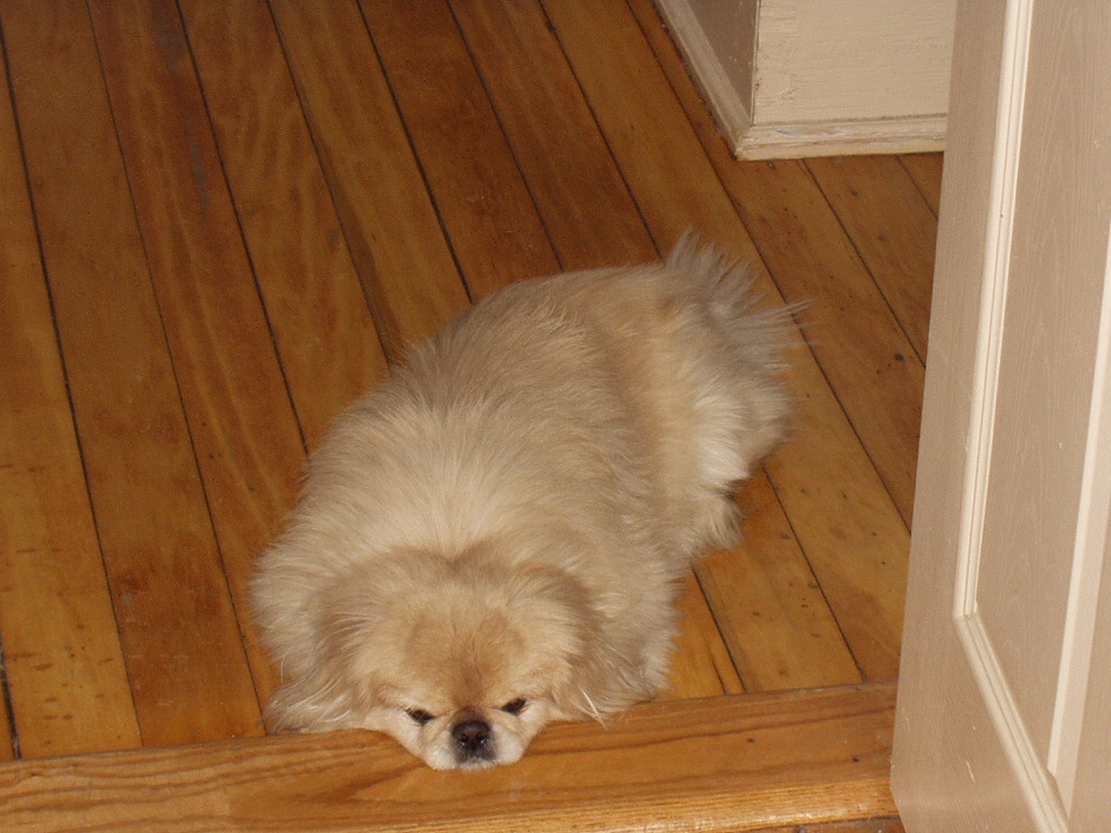
Then the freaking Fed Ex guy knocks on my door at 1000 and I let him leave. Cause it would be a struggle to accept the FedEx letter and prevent the dog from trying to bite him at the same time.
So anyway I ended up getting up at 12 and didn't really leave the house until 4. I went to pick up the FedEx letter at the FedEx office then had a bite at Subway. It was too lat enow, and I just didn't really feel like cleaning tonight.
I left a VM at job#2 office. Telling him I would clean one place tonight and the rest tomorrow. But it looks as if I am just going to sit at home and watch some Dish Network TV -take a break for once.
2004-12-31
2004-12-30

Vets
Taken my dog to the vets this morning. He was ok. I was a bit worried that he would bite the vet.
His annual checkup and "dog license" cost $112.52. And I have to go back every 3 months for a new heartworm prevention medication. I am just glad he did OK.
His annual checkup and "dog license" cost $112.52. And I have to go back every 3 months for a new heartworm prevention medication. I am just glad he did OK.

2004-12-28
New music
In the never ending search for new music I found the following. (apologies for the low quality)
Some no name rock, 56K The intro is good but when the vox comes on it kind of sucks.
Quality chill stuff. (128K) But so short! :(
This stuff is weird. It would probably go good in a horror flick or a Scifi Flick. I bet if Robots wanted to listen to music they would probably listen to this. Psychedelic factor +++ (128K)
And by the same person, this stuff could go to a DOOM soundtrack, freaky, dark, and psychedelic to the max! (128K)
A cool song from the 80's -- remix. I used to love this song back in the 80s. (256K)
Lastly a set -which I haven't heard all of it, but the intro sounds promising. Three minutes into it and it sounds pretty good I will download it and see how it goes. (256K)
It's that time of year again
I have paid my bills for this time around and I just was looking though them. I noticed this little bit of info (below) and was a bit mad. I know it's only $5 but damn!
That sort of relfects my overall mood lately.
Nothing else to report really.
That sort of relfects my overall mood lately.
Nothing else to report really.

Now cold
I was doing my night office cleaning tonight. There is one place I do where two women always use these small space heaters. The problem is, they leave these on after they leave. It used to piss me off in a way, I would think that these could start a fire. So sometimes I would unplug them and place them on these ladies desks' to prove a point.
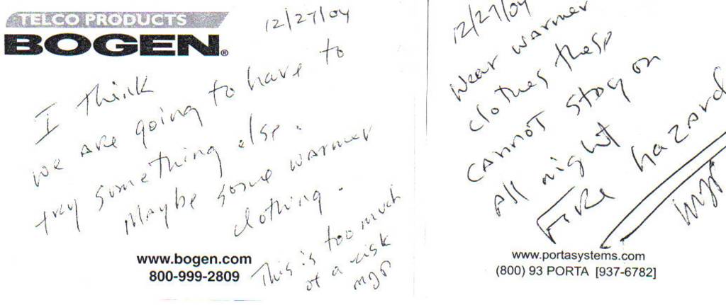
Finally the manager of the place left a note attached to both of them and they cracked me the hell up so much I had to copy them on the copy machine and share them with you.
In case its hard to read the one on the left says:
"12/27/04 I Think we are going to haveto try something else. Maybe some warmer clothing. This is too much of a risk. -MJP"
And the one on the right says:
"12/27/04 Wear warmer clothes these cannot stay on All night Fire Hazard. -MJP"
Cracks me the hell up.


2004-12-27
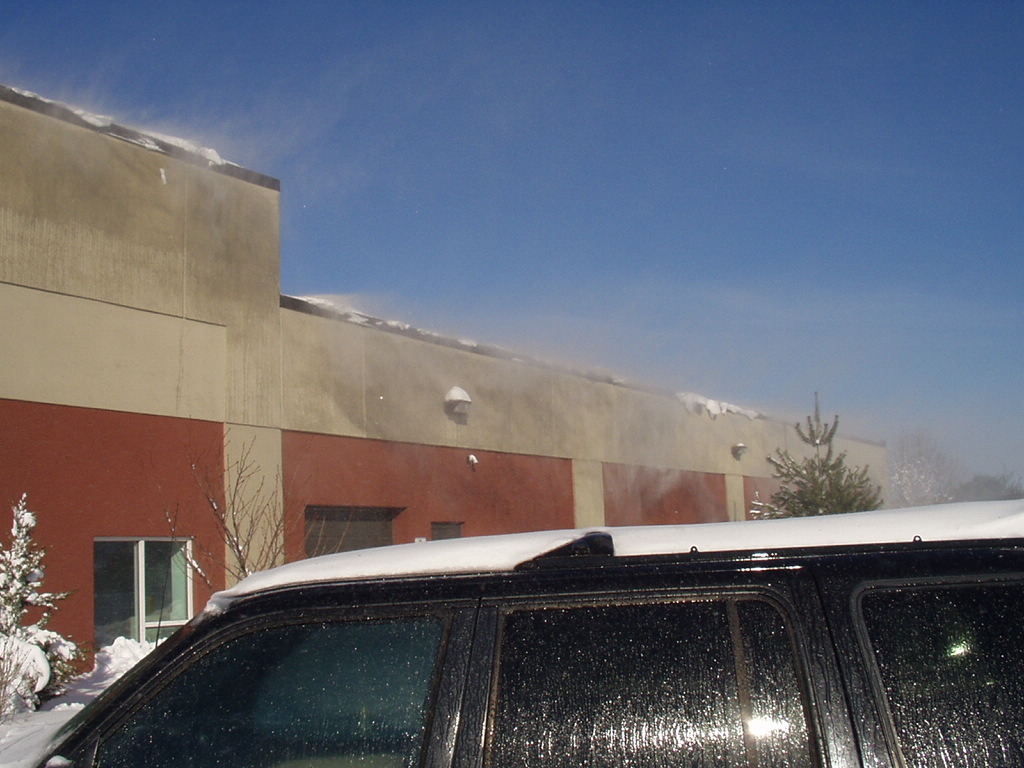
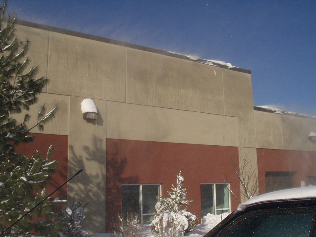
Snow
It is snowing now, and won't stop until tomorrow.
Tomorrow I go back to work. :( But it will be a slow week.
From the NWS:
Overnight. Snow. Heavy at times. Visibility one quarter mile or less at times. Additional snow accumulation of 4 to 6 inches. Windy with lows around 20. North winds 20 to 30 mph with gusts up to 45 mph.
Monday. Mostly cloudy with snow likely in the morning. Then partly cloudy with a chance of snow showers in the afternoon. Storm total snow accumulation 8 to 14 inches. Brisk with highs around 20. North winds 15 to 25 mph with gusts up to 40 mph. Becoming northwest 10 to 15 mph with gusts up to 25 mph in the afternoon. Chance of snow 70 percent.
National Weather Service Taunton MA
939 PM EST Sun Dec 26 2004
Short term (overnight): Local surface analysis shows a coastal front in place from north of Ipswich in Essex county around the western 'burbs of Boston and south through Norton to either Westport or little compton. Winds to the east of there are east-Northeast and temperatures are in the lower 30S. Temperatures quickly cool to the north and west of that line to 20-25. The sharpest temperature gradient seems to be from near Attleboro north to near Reading.
Meanwhile, strongest reflectivity on kbox is from just south of little compton northeast through the Cape Cod canal to near Provincetown, moving north. Expect the heaviest snowfall in the next few hours as this band lifts north. Also expect the heaviest snowfall where this intersects the coastal front (and its lifting capability).
Extrapolation of the storm motion places the center moving past our latitude around 09z-11z, so expect the snow to start tapering off around or just before sunrise.
Overall, no major changes to the forecast. Will adjust temperatures in Eastern Mass to reflect current obs, but with a cooling trend toward morning.
Aviation:
Ifr west to low ifr east through at least 09z, Then improvement to
mvfr during the morning as the storm moves off to the northeast.
moisture field dry sufficiently to break ceilings during the
afternoon from west to east with clearing in most tafs by sunset.
Marine: Observed seas at 013 and 029 and 018 continue to build.
will increase forecast sea heights for tonight and Monday by
approximately 5 feet. Also will increase from gales to storms over
the anz250 Merrimack River to Plymouth zone. Isle Of Shoals is
pegging 48 kt gusts and 018 is peaking at 49 kts.
Previous discussion: (Issued 430 PM EST Sun Dec 26 2004)
Short term (tonight through Monday), near blizzard conditions expected at times coastal MA tonight. expanded winter storm warning this afternoon to cover all Eastern Massachusetts and now all of Rhode Island. Continue to see trend of coastal low pressure intensifying faster than models initialize, which leads us also to hedge a slightly more Westerly track. Northern And southern short wave trofs will begin to phase at our latitude, and thus thinking will see some blossoming of snow across area. Ocean effect snowfall likely to still enhance snowfall rates even as main precipitation shield overspread region along and SE of ash-Orh-Ijd line. Snow growth physics a little tricky with this kind of set up with somewhat bimodal vertical motion cores showing up in eta bufkit. nonetheless, believe can get favorable growth as warm as -8C in salty marine environment. High snow to water content ratios will keep us leaning fairly high on snow totals. Believe much of Eastern MA will 6 to 12 inches but local coastal front enhancement could produce locally higher amounts, perhaps to 15 inches. Other issue is increasing wind tonight will cause extensive blowing and drifting with near blizzard conditions in exposed areas.
Noting rain changed to snow over Cape Cod and Marthas Vineyard even with E wind. As wind begins to back this evening, expect rain on Nantucket to change to snow. Combination of wind and snow will produce near blizzard conditions later tonight over the Cape and islands as well.
Have concurred with results of wind algorithm using eta12 data, which produces gusts to 60 mph outer Cape and Nantucket for several hours in roughly a 10 PM to 5 AM window. Thus, have hoisted high wind warning for Cape Cod and Nantucket for tonight.
Will need to monitor closely this evening need for possible upgrade to blizzard warning for portions Eastern MA including Cape and islands.
Snow advisory continues as origninally posted for Hillsborough County NH, extending just W of winter storm warning area into Northern CT. May See some banding to NW of main coastal storm shield as short wave trough in northern stream begins to interact, and May have to expand snow advisory to rest of forecast area later.
Wind backs to NW and consolidating upper trofs pass E of forecast area during Mon morning. Anticipate fairly rapid improvement most areas after daybreak, although accumulating snow May persist to midday over Cape and islands. Temperatures will tend to remain steady or rise only slight Mon due to cold advection. Have gone with a blend of gfs and eta statistical guidance for temperatures, with consideration to neighboring gridded fields.
Long term (Monday night through Sunday), very good agreement between the operational models and ensembles beyond 00z Tuesday, both at the surface and 500 mb. There are still some minor differences in the handling of a frontal boundary moving through the Great Lakes Wednesday into Wednesday night, mostly with respect to the timing. The eta is the lone model out, being much quicker with the passage of this front than the gfs, ecmwf and ukmet. I have leaned toward the consensus solution for Tuesday and Wednesday.
Mostly a series of high pressures expected this week, with below normal temperatures to start, increasing to above normal temperatures for next Friday and Saturday. A series of cold fronts are expected Saturday night into Sunday, returning temperatures to more seasonable readings.
Mav and mex guidance temperatures look reasonable, so will not stray too far from those.
Aviation, widespread ifr conditions with vsbys below 1 mile and cigs below 1 thousand Ft across most of region, lowest along and E of mht-Afn- orh-Ijd line. Also, surface wind gusts to 40 kt possible E coastal Massachusetts, and to 50 kt possible khya to kack region 03z to 09z.
Marine, for tonight, expanded storm warning to anz255 as anticipating wind gusts to 50 kt in eastern part of that zone. Have continued with storm warning for anz254 and noted scattered gusts to 50 kt in E portion of anz250. Fairly steep lapse rates in low levels favor bringing winds right to sea surface. Went close to a little higher than wave watch model as a result with 15 to 20 Ft seas expected outer SE coastal waters. Astronomical high tide tonight relatively low, but seas of 15+ Ft with anticipated 2 foot surge May cause splashover in the more vulnerable areas.
In the longer term Monday night and beyond, seas will slowly subside into Tuesday as the coastal storm moves to newfoundland. By late Tuesday, seas should be below 5 Ft across the coastal waters. Seas then start to briefly build once more across the outer waters with a persistent southwest wind Tuesday night, before high pressure takes over Wednesday and Thursday.
.jpg)


2004-12-26


Subscribe to:
Posts (Atom)


